
India's Ancient Ram Setu Gets First-Ever Undersea Mapping
Scientists from ISRO have created the first-ever undersea map of the ancient Ram Setu, a 29-kilometer stretch connecting India and Sri Lanka. The mapping exercise has revealed valuable insights into its geology and history.
Tue, 09 Jul 2024
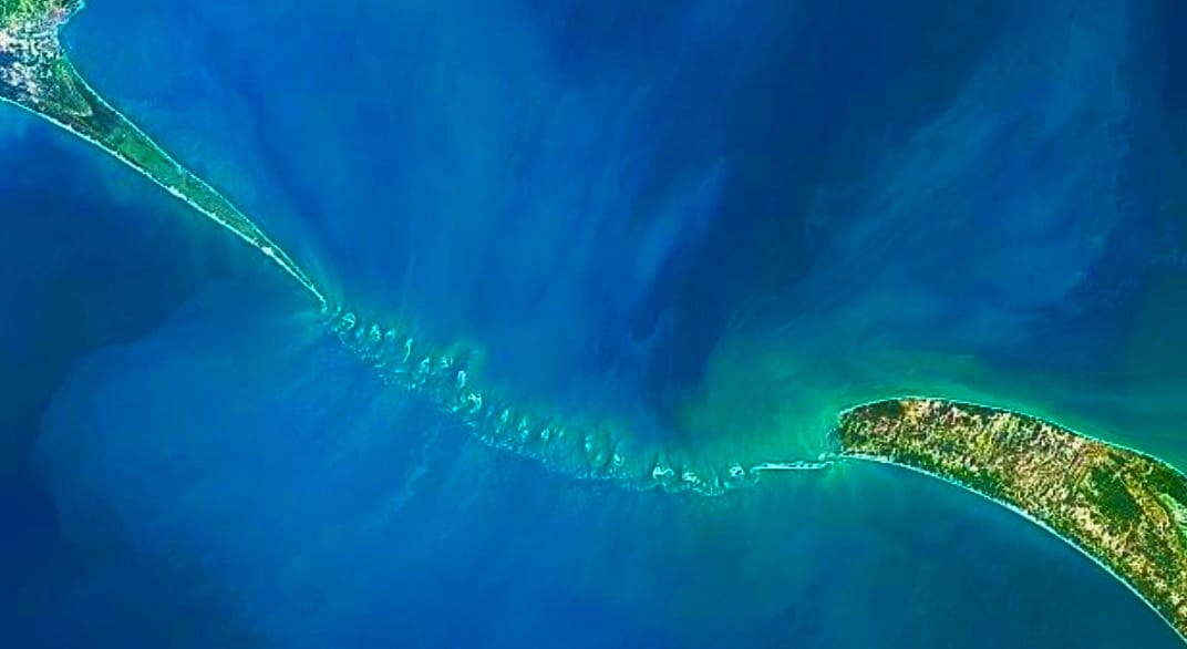
In a groundbreaking achievement, scientists from the Indian Space Research Organisation (ISRO) have created the first-ever undersea map of the entire Ram Setu, a 29-kilometer stretch of limestone shoals connecting India and Sri Lanka. This remarkable feat has shed new light on the ancient geological formation that has fascinated historians and archaeologists alike.
According to the ISRO scientists, an astonishing 99.98% of the Ram Setu is buried beneath shallow waters, with the remaining 0.02% visible above the surface. The mapping exercise has revealed that the structure stands at a height of approximately 8 meters from the seabed, providing valuable insights into its geology and history.
BIG BREAKING NEWS 🚨 ISRO scientists create first undersea map of complete Ram Setu.
— Times Algebra (@TimesAlgebraIND) July 9, 2024
99.98 percent of the Ram Setu, a 29-kilometer stretch of limestone shoals, is buried in shallow waters.
Ram Setu spans from Dhanushkodi, Rameshwaram Island in India to the Mannar Island of Sri… pic.twitter.com/UDQYtTZzcb
Ram Setu stretches from Dhanushkodi on Rameshwaram Island in India to Mannar Island in Sri Lanka, covering a significant portion of the Indian Ocean. The creation of this undersea map marks a crucial step forward in our understanding of the region's geography and potential for future archaeological discoveries.
As scientists continue to explore and analyze the data from this remarkable achievement, it is clear that the Ram Setu holds many secrets waiting to be uncovered. This incredible feat of scientific mapping has opened up new avenues for research and discovery, offering a glimpse into the region's rich history and cultural heritage.
Published by Chronicles Of India. Scroll down to read more
